Getting to your destination has never been easier, thanks to a number of popular global positioning systems (GPS) -based navigation apps available for download on smart devices. In fact, using these apps has become second nature to many drivers; according to the website The Pew Research Center, 67% of smartphone owners use their phone at least occasionally for turn-by-turn navigation while driving, with 31% saying that they do this “frequently.” The apps can be a life saver when you are stuck in traffic and desperately need to identify a new route. But what if you’re a first responder—an actual life saver—and you need to get to an emergency scene the fastest way possible, and possibly in an oversize vehicle?
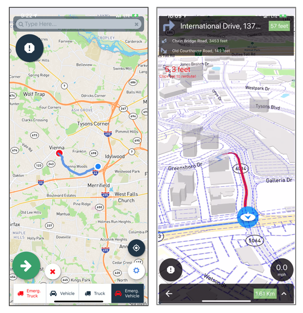
For first responders, there can be drawbacks to using the same apps and following the same routes as everyone else. The apps may not take into account specific factors that can delay response time, like weather events, traffic accidents, or the size and weight of their vehicles. They also do not take into account local roadway or speed limit rules for emergency vehicles. When every second counts getting to an emergency scene, good enough just won’t cut it. That’s why the Department of Homeland Security Science and Technology Directorate (S&T) and partner Azimuth1, LLC are developing a solution, an app called QuickRoute.